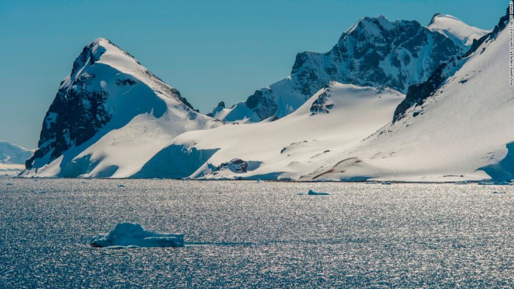
(CNN) — Millions of children around the world have grown up memorizing basic facts about geography: there are seven continents and four oceans.
Until now.
This confluence of the southernmost stretches of the Pacific, Atlantic and Indian Oceans has always been an interesting — and sometimes contentious — spot for oceanographers.
What’s in a name?
Usually, changes to world maps are the result of political changes — for example, Czechoslovakia splitting into the Czech Republic and Slovakia, or Swaziland voting to change its name to Eswatini.
But instead of reflecting a change in the world, the Fifth Ocean is a rare example of a mapmaker making an effort to alter the planet.
National Geographic geographer Alex Tait explains why naming conventions can be so important.
“Part of mapping the world is using place names and features that are in common use among people who are describing the world, and this gets into some other things other than geopolitical naming,” he tells CNN Travel.
“The oceans are one of those things, so we want to keep track of how scientists, travelers, writers, people are using place names.”
Tait is quick to add that although National Geographic’s prominence in the mapping world gives its official decree more weight, others have been using the term Southern Ocean already.
“Oceanographers will probably rejoice that (the Southern Ocean) will be on Nat Geo maps,” says CNN’s climate editor Angela Fritz. She adds: “I can’t think of any earth scientists who disagree (with the designation).”
How to make an ocean
When it comes to understanding oceans, you need to start with the basics, says Tait.
“There’s one world ocean and it’s all interconnected,” he notes.
“We’re really talking about ocean regions, and there’s traditionally been the four: Atlantic, Pacific, Indian and Arctic. But for many, many years, scientists and others have been using the term Southern Ocean to describe the physical region of the ocean around Antarctica.”
So then, what makes the Southern Ocean different?
Tait breaks it down.
“You go from warmer waters in the Atlantic, Pacific and Indian Oceans to very cold waters around Antarctica. And then the salinity goes down. There’s a distinct fauna there, so minke whales, certain kinds of seals, penguins, fish and bird life are abundant in the Southern Ocean based on those environmental factors.”
Part of the motivation behind National Geographic’s decision to name a fifth ocean, which was announced on World Oceans Day (June 8), was that giving a place a name can also give it status.
Ocean conversation is a huge project, and it’s easier to raise awareness about the Southern Ocean than it is to do the same about “that one area of water.”
Although many countries and organizations around the world recognize the Southern Ocean, not everyone is on the same page about exactly where it is.
National Geographic officially uses the 60 degree south latitude to draw the water border. However, Australia considers everything south of its country the Southern Ocean.
In addition, climate change plays a role in trying to determine where its borders could be.

A National Geographic map shows the Southern Ocean.
Courtesy National Geographic
Going there
French explorer and environmentalist Jean-Louis Etienne recently announced that he had invented a floating lab specifically designed for studying the Southern Ocean.
His creation, nicknamed the Polar Pod, doesn’t have a motor and will float in the water at a slow speed in order to “orbit” Antarctica and gather data.
Etienne is aiming to complete and then deploy the Polar Pod by 2024. But the Southern Ocean’s waters aren’t empty for the time being.
That said, it’s going to be hard for regular travelers to add the Southern Ocean to their bucket lists. Travel here is difficult, but not impossible — basically, you’ll need to join a ship going to Antarctica.
And be sure to pack your anti-nausea pills, because the water is notoriously choppy.
Correction: A previous version of this story misidentified the confluence of oceans now recognized as the Southern Ocean by National Geographic cartographers.
You may also like
-
Afghanistan: Civilian casualties hit record high amid US withdrawal, UN says
-
How Taiwan is trying to defend against a cyber ‘World War III’
-
Pandemic travel news this week: Quarantine escapes and airplane disguises
-
Why would anyone trust Brexit Britain again?
-
Black fungus: A second crisis is killing survivors of India’s worst Covid wave

