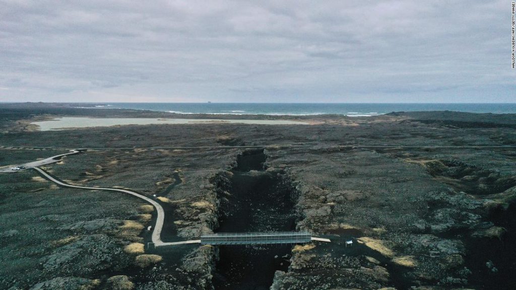
The largest quake, a magnitude 5.6 on the Richter scale, occurred on the morning of February 24. It was the loudest in a swarm that continues to rattle residents in the nearby capital city of Reykjavík and the municipalities around it, where two-thirds of the Icelandic population lives. Two larger earthquakes — over magnitude 5.0 — also hit on February 27 and March 1.
The quakes have caused little damage so far, though Iceland’s Road and Coastal Administration has reported small cracks in roads in the area and rockfalls on steep slopes near the epicenter of the swarm.
In the fishing town of Grindavík, locals have had a front-row seat to the tremors. “I’ve not experienced anything like this before,” says Páll Valur Björnsson, who teaches at the local College of Fisheries and sits as a deputy member of Parliament.
“We are used to it; it started one year ago. But it is much more now — very unsettling. I’m not afraid but this is uncomfortable. I woke up twice last night because of [tremors]. There was a very big one when I went to sleep, and I woke up with one. It is difficult but you have to learn to live with it,” he said.
Only this time, there seems to be no end to the rumble under the ground.
Þorvaldur Þórðarson, a professor of volcanology at the University of Iceland, said concerns over the recent activity are understandable. “Of course it worries people. For this region, this is actually fairly unusual, not because of the type of earthquakes or their intensity, but for their duration. It’s been going for more than a week now.”
“We are battling with the ‘why’ at the moment. Why is this happening? It is very likely that we have an intrusion of magma into the [Earth’s] crust there. It has definitely moved closer to the surface, but we are trying to figure out if it’s moving even closer to it,” he said. With multiple volcanoes in the area, local officials have warned that an eruption could be imminent.
Elísabet Pálmadóttir, specialist in natural hazards at the Icelandic Meteorological Office, told CNN that authorities are deploying surveillance equipment in the area, from GPS and earthquake monitors to web cameras and gas detectors.
She too can’t remember having ever experienced so many earthquakes over such a long period of time. She warns that a more powerful event could be cause for concern, and estimates that the area could experience a magnitude 6 earthquake or above.
“In this particular area, where we’ve seen activity in the past week, we could experience a magnitude 6.0 earthquake. But we could have a 6.5 to the east of the area, east of the Kleifarvatn Lake,” she says.
No towns appear to be at risk from lava flows in the event of a volcanic eruption, according to the latest modeling by the University of Iceland’s Volcanology and Natural Hazard Group, which released maps of potential flows on Wednesday.
“Based on the current model, no major town is in harm’s way,” volcanologist Ármann Höskuldsson told CNN, adding that Keflavík International Airport — one of the most direct connections between Iceland and the rest of the world — would also be spared.
However, the main road connecting the airport to the capital, Reykjavík, could be impacted, as could some powerlines, he added.
Pálmadóttir notes that such models do not account for possible dangerous gases that could be emitted from a volcanic eruption.
Þórðarson adds that “the magma composition here is very different, the intensity of explosive activity would be significantly less.”
On Wednesday afternoon, a tremor close to the Keilir volcano, just 20 miles south of the capital, prompted authorities to ban traffic in the area. On its webpage, the Icelandic MET Office says similar activity has previously preceded eruptions.
Víðir Reynisson, Chief Superintendent at Iceland’s Department for Civil Protection and Emergency Management, told a news conference on Wednesday that an eruption was “more likely than not” within the next few hours. It would be the first in the area since the 12th century.
For now, residents await signs of an eruption, some with excitement, others with anxiety. Víkurfréttir, a local news service, has installed a video camera pointing at Keilir, which will start livestreaming should an eruption start.
In the last 24 hours, the large earthquakes felt the previous days have largely subsided — but the current lull may not last for long. “It’s definitely not over,” says Pálmadóttir.
You may also like
-
Afghanistan: Civilian casualties hit record high amid US withdrawal, UN says
-
How Taiwan is trying to defend against a cyber ‘World War III’
-
Pandemic travel news this week: Quarantine escapes and airplane disguises
-
Why would anyone trust Brexit Britain again?
-
Black fungus: A second crisis is killing survivors of India’s worst Covid wave

