
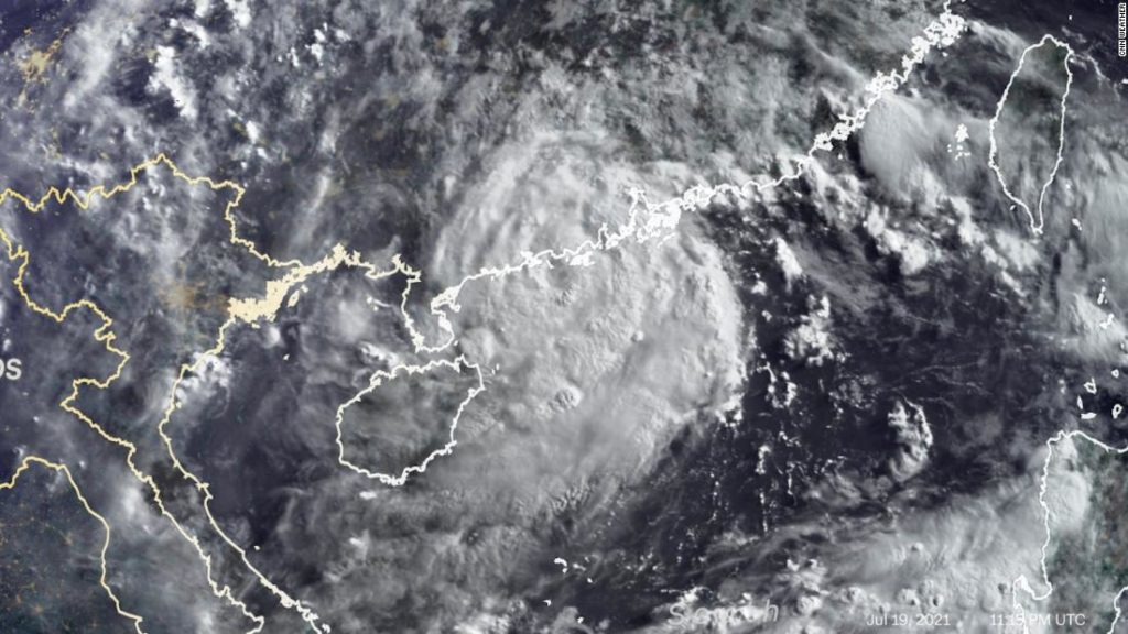
The storm had winds up to 120 kph (75 mph) and was located about 185 km (115 miles) southwest of Hong Kong as of 5 p.m. ET. Further intensification is not expected as it nears land.
Landfall is expected Tuesday afternoon or evening local time near the city of Yangjiang in southeastern China’s Guangdong Province.
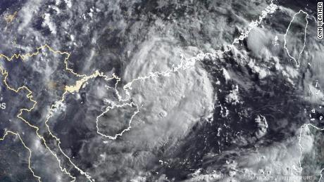
A Strong Wind Signal No. 3 was in effect for Hong Kong, indicating wind speeds of 41 to 62 kph (about 25-40 mph) are expected, according to the Hong Kong Observatory’s typhoon warning signals.
Cempaka will bring heavy, flooding rains to southeastern portions of China through much of this week. A widespread 100 to 200 mm (about 4 to 8 inches) of rainfall is forecast for the provinces of Guangdong, Guangxi and Hainan. Isolated locations could approach 500 mm (about 20 inches) through Friday local time. There will also be strong, gusty winds, especially near the coast where the storm will make landfall, which could cause isolated power outages.
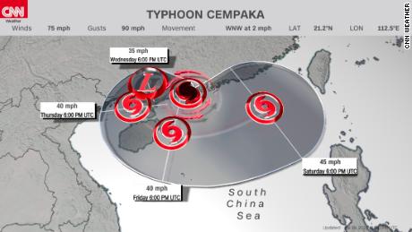
The Joint Typhoon Warning Center said it expects Cempaka to meander over these provinces and possibly emerge back over the South China Sea by this weekend, keeping an elevated risk for rain and flooding, especially near the coast.
You may also like
-
Afghanistan: Civilian casualties hit record high amid US withdrawal, UN says
-
How Taiwan is trying to defend against a cyber ‘World War III’
-
Pandemic travel news this week: Quarantine escapes and airplane disguises
-
Why would anyone trust Brexit Britain again?
-
Black fungus: A second crisis is killing survivors of India’s worst Covid wave