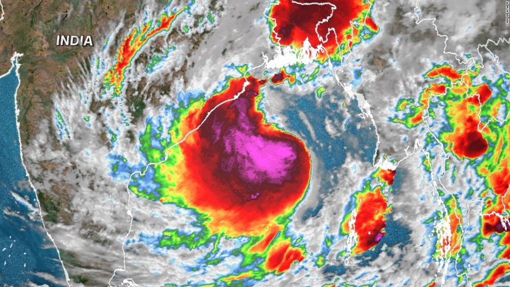
Tropical Cyclone Yaas is intensifying over the Bay of Bengal and is already producing waves of up to 25 feet.
The cyclone will likely “intensify further into a Severe Cyclonic Storm during next 6 hours and into a Very Severe Cyclonic Storm during subsequent 12 hours,” says the India Meteorological Department (IMD).
The very warm water temperatures will fuel rapid intensification over the next day. Sea surface temperatures are estimated to be as warm as 34 degrees Celsius (93 degrees Fahrenheit) in the northern Bay of Bengal.
It is expected to make landfall between Paradip and Sagar islands by midday Wednesday local time. Winds are currently forecast to peak at 150 kph (93 mph) near the time of landfall. This is equivalent to a Category 1 hurricane in the Atlantic and eastern and central Pacific Oceans.
Heavy rainfall could cause flash flooding in northeastern India, with a widespread 150 to 250 mm (6 to 10 inches) of rain and isolated totals over 250 mm likely. Some of the outer rain bands on the eastern side of the storm may lead to some flooding across portions of Bangladesh.
There will also be storm surge, with water inundations of 2 to 4 meters (6.5 to 13 feet) forecast along coastal sections of Odisha and Kolkata regions, according to the IMD.
About 90 cyclones with winds of at least Category 1 hurricane strength (about 120 kph) have hit northeastern India or western Bangladesh.
Tropical cyclones can form year round in the North Indian Ocean, but are especially common in the spring ahead of monsoon season.
You may also like
-
Afghanistan: Civilian casualties hit record high amid US withdrawal, UN says
-
How Taiwan is trying to defend against a cyber ‘World War III’
-
Pandemic travel news this week: Quarantine escapes and airplane disguises
-
Why would anyone trust Brexit Britain again?
-
Black fungus: A second crisis is killing survivors of India’s worst Covid wave

